

“Effective Mapping Protocol for Forest Rights Mapping in India”
Secure land tenure is critical to alleviate poverty, augment food security, help adapt to climate change. Land tenure security is often equated with clear, transparent and updated land records; documenting the personal, parcel and tenure information under prevailing legal regime. However, less than 50% of countries have mapped or registered private land in capital cities, and less than 30% of countries maintain digital land data for effective urban decision-making (Deininger, 2018). India has to map and update about 1.5 billion parcels, estimates NRMC Centre for Land Governance. India Summary report of Land Governance Assessment Framework (2015), by the World Bank underlines the importance of investing in mapping pilots to address the tenurial heterogeneity, with clear criteria to assess success or failure, time frames, cost-effectiveness and strategies for up scaling of successful approaches.
Forest Rights Act enacted in 2006 have seen as a slow pace in recognition of claims in favour of isolated indigenous communities; a major reason is lack of surveyors on ground to assist the Village Assemble (Gram Sabha) and also the limited transparency and uniformity in the processes of recognition and integration of rights in the registry. Claimed as the biggest land reform in the world, about 150 million people living in 0.17 million villages FRA has the potential to recognize individual and community rights over 40 million hectares of forest land, almost half of India’s forest. However, with a decade already gone, about 13 million acres, (<15% of the potential) has only been realized to date, with conflicts over claim rejection, maps, possession shrouding the implementation process. Such limited and ad hoc efforts may redo the injustice that FRA attempts to undo as per its preamble; an example is recent supreme court case threatening potential eviction of 1.91 million forest dwelling households. The FRA attempts to undo the injustices allegedly made during rights recognition/alienation process under the Indian Forest Act implementation or the wrongs committed during the process of Revenue Survey and Settlements. Therefore, it is critical that the recognition of forest rights must ensure an inclusive and just process to avoid perpetuation or repetition of similar injustices, unjust denials and future conflicts. Analysts citing the recent Indian election results in some central Indian states (viz. Chhatisagrh, MP, Jharkhand etc.), with dominant tribal population and forest rights potential, highlight the need of expediting the forest rights recognition to stem citizen discontent, unrest and ensure inclusive growth and development.
Global Scenario
Effective land administration is a cornerstone of good governance; critical for delivery of services, collection of revenue and effective planning by governments at all levels. Population growth and an increasing competition for land has outpaced the growth in land professionals or the ability for governments to provide services to citizens in many countries. While programs to improve land information management have been a development priority for decades, few countries can boast to have a registry and cadastre with national coverage, leaving the majority of citizens globally without secure rights to the land they occupy.
Despite the considerable investment by the donor communities and national government alike, the degree of informality in land rights has not significantly changed in recent decades. There has been a growing recognition of this fact, as witnessed by the recent joint World Bank and International Federation of Surveyors (FIG) publication, Fit for Purpose Land Administration in 2014, which highlighted the issues of building sustainable land administration systems as opposed to “blindly complying with top-end technological solution and rigid regulations for accuracy.” This is particularly relevant in rural and forested areas, where highly precise measurements may have limited utility when measuring boundaries which are vaguely defined, cover vast areas, whereas there is an urgency to recognize rights faster, as the case of FRA in India.
Rapid advancement of technologies and their increasing accessibility, of late, has become a focal point of enabling change. Traditional surveying methodologies are now considered too expensive, too elitist and exclusive and hence, too unrealistic (Enemark, Bell, Lemmen, & McLaren, 2014). A ‘third-generation’ of land tools[1] are now emerging to make the technical aspects of titling and registration cheaper, easier and more responsible (Bennett et al., 2017). Endorsement by the international donor and surveying community alike, coupled with advancements in technology, has led to a growing recognition of the utility of adopting low cost approaches to secure land rights and develop an effective land administration system. Governments, NGOs and businesses welcome them with legal reforms, institutional innovations and investments. Innovative land administrative platforms, now integrate personal information, spatial location and parcel characteristics, such platforms offer positive development-externalities beyond land records, viz. around land use planning, multi-purpose cadastre etc. From Ghana to India, global and local agencies are piloting and upscaling such mapping, through innovative use of technology, low-cost option and partnership-ecosystems and social-entrepreneurships[2].
While the advances of geospatial technology, tools and platforms simultaneously expand opportunities, the complexities of India’s plural land tenure systems and evolving legal, social, cultural and ecological concerns, demands local adaptations and strategic localization. Growing recognitions of ethics, data privacy, free and prior informed consent as well as human rights issues associated with land tenure digitization and mapping, more so in forest rights context, implicate their strategic embedding to address inevitable sustainability, participation and inclusion. Adequate due diligence in surveying and mapping of forest rights is there critical; particularly understanding and analysis of role of technology – both as tools and in processes, merit close attention.
Methodology
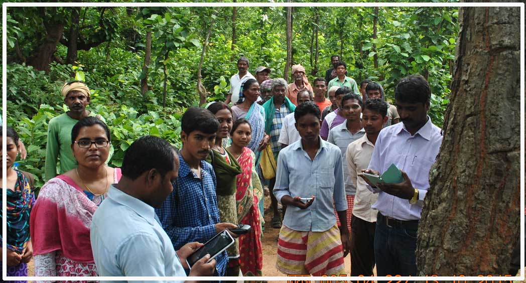
The pilot adopted the community led mapping process through a partnership approach with local organization and community institutions, as per their demand for mapping of parcels in the two selected villages each in Odisha and Chhattisgarh. This pilot ensured that all stakeholders are brought together including the community, government, user organisation, and technology providers to have a common understanding on the objectives and outcomes of the mapping exercise.
The process designed with an aim to be simple, adaptable, and scalable to integrate the new change of existing land rights. It involves the local services providers and local institutions by providing access, familiarity, and acceptance of the model. The technology adopted is downsized and made for a fit-for-purpose approach. Different technological options were tested with the objective to lower the cost, ensure participation, legal compliance, and pilot both online and offline options to use.
The process started with a community sensitization particularly engaging with the Forest Right Committee (FRC) following the provisions of FRA and ensuring observance of prescribed role and responsibilities in the claim making process. The sensitization followed by the participatory mapping and defining the village boundary by identifying physical features (bisections/ trisections stones) through DGNSS and geo-referencing the cadastral map where available.
For pilot four categories of land parcel were selected as sample. These are open field, open woodland, low dense forest, and moderate dense forest. The characteristics of each category of land were explained to the community members and they were facilitated to select two parcels of each category for mapping. To ensure appropriate boundary marking the community members put wooden/ bamboo stumps on the boundaries of the parcel (in each corner/ bend points).
The mapping of the sample land parcels were made using multiple devices which includes single frequency mobile phone, dual frequency mobile phone, tablets (small and large Samsung model), simple external antenna (Bad Elf & Gagan Dongle), sophisticated external antenna (Geolysis GNSS). For comparison purpose, ETS was used to map the same sample parcels.
The first test conducted under the pilot was precision test (static test) to examine the ability of each device to obtain a fixed location. The second test was the accuracy test (rectangle test) to examine the ability of the device to record ta shape as accurately as the control sites. The third was the real world test where the field plots were mapped to see how accurately the devices and app software allow real lot boundaries to be described, examining the effects of accessibility to scrub covered corner points, describing sinuous boundaries. It also examined the human computer interface and monitor how well users were able to capture both geographical and attribute information.
Result
Each of the tests conducted showed predictable trends in precision and accuracy. Where the canopy was not present or thin, measurements were more accurate and would remain at the same point more often when conducting the temporal precision tests. Overall, the plots were more accurately described in open canopy than in dense cover, and for most devices, all the marker points were easily recorded. As canopy becomes denser, the reliability drops and several devices (including the dual frequency device which is meant to have a wider choice of satellites) were unable to measure all locations in a plot.
Within this general trend, some devices performed better than others. The Geolysis DGNSS, when measured against the ETS performed the best[1]. Both the Gagan Dongle and the Bad Elf increased the accuracy of the mobile devices but in some instances was not reliable under canopy. The Gagan Dongle in particular had some erratic errors of up to 4m from the control measurement but gave a fair result in most cases. The Mi8 dual frequency phone did have some instances where it was very accurate, but,
particularly under canopy, gave either large errors or was not able to record locations at all. Of the single frequency devices, the Samsung tablet gave the gave good results in the most cases.
Using the mapping facility by digitising on satellite imagery on the CADASTA platform (and the large tablet) proved difficult. The field conditions made it difficult to see the imagery clearly and even where boundaries were obvious (on rice field bunds) it was difficult to obtain sufficient accuracy to digitise well and in some cases, the field to be digitised was misidentified on the imagery. Where tree cover existed mapping using the satellite imagery proved impossible even a large canopy tree in relatively open canopy obscured the boundaries enough to make digitising difficult.
When entering the attributes, the results were generally device neutral. Using a tablet gave some advantage as the forms were clearer, but the effect was marginal. With both recording locations and entering information, the touch sensitive screens could occasionally cause errors; the user may accidently hold the device in a way which recorded erroneous points at the screen edge, or move the form on without data being entered.
Some of the errors recorded could be attributed to the experience of the team and familiarity with the device (particularly as the full methodology had several elements and quality control was needed to ensure standard measurements). A rain delay and poor light in Bhaluntangar may account for some of the more erratic results recorded that day.
The consequence of failing to identify points compromises any areal calculation, as does recording significantly erroneous points. Despite these difficulties, comparing errors calculated by the control device (ETS or Geolysis) with the other devices shows again that the Bad Elf performs well, and the Gagan Dongle has fair results. It shows that an external device significantly improves the accuracy for relatively low cost.
Usability
The overall user experience was moderately easy in using the mobile application and survey devices. While the users found it very easy to use single frequency, double frequency and digital imagery for mapping. The users who were using external antenna particularly Bad ELF and Gagan Dongol found it easy to use. The users who were using Tremble and Geolysis GNSS found it moderately easy.
The major challenge which was faced by the users during the mapping exercise was to establish the connectivity between the external antenna and mobile device for mapping. During initial setup equipment like Bad ELF and Tremble took a little more time to set up as compared to other devices. However, being internet dependent, the Trimble antenna was not used much as there was no internet connectivity in the villages where the mapping pilot was conducted. However, a user variability analysis is conducted to assess the user experience in different contexts.
Discussion
The study has extensively explored the devices, processes, ergonomics, useability, and issues of forest rights mapping with a series of tests. The main intention is to identify which is the best suited tool or combination of tools for forest rights mapping, but many important ancillary issues have been raised which cannot be ignored. Better technology by itself is not the cure all for mapping; app design, survey design, training, community sensitization and quality control have to be considered to make a coherent and rigorous solution. Irrespective of individual devices, the static, rectangle and field tests have shown that canopy cover is a major factor in reducing the precision and accuracy determining location, in the most extreme cases barring the collection of data. The more expensive and sophisticated the tool meant that both time related precision and spatial accuracy are better overall, and do not degrade as significantly as environment becomes more difficult to work in. From the limited set of results possible from the field studies, it is difficult to tease out the issues related to the variability in some devices in gathering reliably accurate data. Despite the controls taken to standardise the testing methodology, out human errors cannot be ruled out in the recording of points and cannot fully identify what the constellation of satellites in the sky were at any point in time.
The combination of good procedures, training including both those procedures and how to deal with troubleshooting issues and quality assurance would probably reduce some of the variability found in the accuracy tests and bring the measurements within the threshold for accuracy in open field and forest environments. There are no good reasons to exclude local community members from the mapping process; these exercises demonstrate that given clear training and guidance, almost any smartphone, tablet and combination smart phone/ tablet with simple external antenna (Gagan Dongle or Bad Elf) are all easy to use tools, and the Survey123 app can sit on any mobile device once access given to the license. The inevitable fact that use of technology also raises the expectation of local community, while also triggering participation, however, has to be kept in mind and community must be explained in advance adequately about the caveats and limitations. Also, very important is to ensure Free and Prior Informed Consent around use of technology and collection of personal information, more importantly so, as it involves indigenous communities. The provisions of FRA, as well as the upcoming legal framework around data privacy and ethics, make it more binding.
Conclusion
The study has shown, though, that several of the technical tools pass muster and could in theory be used in parallel or in combination in an actual roll out programme. In canopy up to about 35%, these tools continue to function without serious loss of accuracy. Under thicker canopies there will be a compromise to accuracy, but this may be within acceptable limits when dealing with delimitation of forest boundaries.
What is imperative is to reduce other errors by clearly agreeing and marking boundaries before survey, training personnel to be as accurate as possible and having a reliable quality assurance protocol in place to check results as they are created. The study also highlights the need of more nuanced look at other such technology options including feature extractions and use of EO to supplement and compliment physical mapping interfaces with use of handheld devices by the local community surveyors. What is more importantly also coming out, is the need of localizing and contextualizing technology solutions and information collection, particularly to embed in local socio-cultural, legal contexts and growingly critical, ethics concerns.
Recommendation
It is important to bridge the gap between the need of right documentation land rights with its affordability to the communities needing to have these rights. These tests help to both demonstrate which technology works and what important procedures and training are needed to give the necessary rigour to the documentation. The choice of technology and method are often based on the level of accuracy, time, cost sought for in a given context. However, more important is employing locally adpative training, procedures, and documentation needs while ensuring consent and participation of an informed community and ensuring proper quality control and ethics protocol with in-field checking during the mapping process.
[1] These include point cadastres, digital pens, unmanned aerial systems and machine learning for boundary recognition (Koeva et al., 2017; Stöcker et al., 2019; Zevenbergen, De Vries, & Bennett, 2015) and EO
[2] Perhaps best illustrated in Rwanda, where under the Land Tenure Regularisation Programme approximately 10.3 million parcels were documented at an average cost of less than $10 dollars per parcel in just three years, using a model centered on digitization of imagery and community validation. In Tanzania, USAID developed an approach using smartphones and mobile applications managed by trained community members led to the documentation for over 50,000 households in 2015 - an approach that has now been replicated in Uganda, Liberia, and Colombia to name a few and is now recognized as a viable approach. More recently, drone imagery has proved an effective and cost effective way to document land rights and has been enshrined into law in the Philippines and Colombia. Thee use of new technologies when coordinated with community training and the utilization of “para-surveyors” from within the community resulted in a much more cost effective and timely collection of data.
[3] However, this was not extensively tested as the ETS only gave reliable results for one village and was unable to be deployed in Chhattisgarh, where the Geolysis was taken as the control device in place of the ETS.


